
Blog
What Is the Best Drone Detector from China?
Choosing the best Drone Detector from China requires more than comparing prices or detection ranges. A reliable evaluation should examine radio-frequency coverage, radar support, camera integration, false-alarm control, weather resistance, and data security. These details matter in real settings, where a detector may face concrete walls, crowded wireless networks, rain, or moving vehicles. The most impressive specification sheet may not perform best beside a busy airport or industrial site.
Jörg Lamprecht, founder of Dedrone and a recognized counter-drone technology expert, has said, “There is no silver bullet when it comes to counter-drone technology.” His observation remains important when reviewing Chinese manufacturers. A strong Drone Detector should identify authorized and unauthorized signals without disrupting legitimate communications. It should also provide clear alerts, event logs, and practical software for trained operators. Certification and after-sales support deserve equal attention. A low-cost device can become expensive when firmware updates are unclear or replacement parts take months.
The comparison in this guide focuses on measurable performance and responsible deployment. We will consider detection distance, spectrum coverage, installation effort, interface quality, and independent testing evidence. Some advertised ranges may depend on open terrain. That is a limitation worth admitting. No product wins every scenario. The best choice depends on the site, threat model, budget, and compliance requirements. Careful testing in controlled conditions can reveal weaknesses before purchase. That practical step is often overlooked.
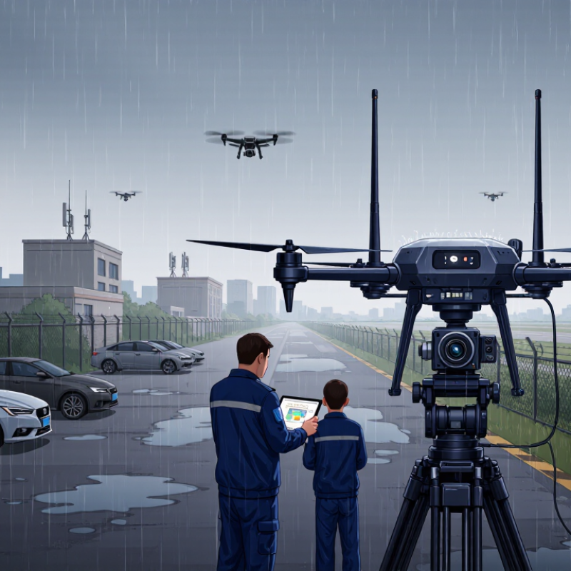
Table of Contents [Hide]
Chinese Drone-Detection Technologies: RF, Radar, EO/IR, and Acoustic Sensors
What Is the Best Drone Detector from China?
Chinese drone-detection technology is strongest when several sensing methods work together. The best choice depends on terrain, airspace, budget, and response time. RF sensors listen for signals between a drone and its controller. They can identify frequency, direction, and possible flight activity. However, autonomous aircraft or quiet communication links may escape RF detection. This limitation matters near industrial sites and sensitive facilities.
Radar adds distance, speed, and movement data, even in darkness. Modern low-altitude radar can track small objects, but buildings, trees, birds, and rain may create false alerts. EO/IR cameras provide visual confirmation. Daylight images help identify shape and behavior, while infrared supports night monitoring. Fog, glare, and heavy rain still reduce clarity. Acoustic sensors use microphone arrays to recognize motor noise and estimate direction. They work best in quiet areas, not beside busy roads or construction zones.
No sensor is perfect.
Field testing shows that layered detection usually performs better than one powerful device. A practical Chinese system should combine RF, radar, EO/IR, and acoustic data through one clear interface. Operators need adjustable alert zones, time-stamped records, and simple maintenance tools. Calibration should be repeated after relocation or severe weather. I would also question impressive laboratory results without outdoor testing. Real sites contain clutter, changing wind, and unexpected radio interference. Reliable procurement requires independent trials, transparent specifications, and measured false-alarm rates.
What Is the Best Drone Detector from China? - Chinese Drone-Detection Technologies: RF, Radar, EO/IR, and Acoustic Sensors
Comparative overview of commonly deployed drone-detection sensor technologies. Actual performance depends on terrain, antenna height, target size, weather, radio behavior, and system integration.
| Technology | Primary Detection Method | Typical Operating Bands or Signals | Indicative Detection Range | Key Strengths | Main Limitations | Weather Performance | Target Information | Typical Role in a Layered System | Overall Suitability |
|---|---|---|---|---|---|---|---|---|---|
| Radio Frequency (RF) Detection | Detects, classifies, and sometimes geolocates radio transmissions between a drone, remote controller, or telemetry network. | Commonly analyzes unlicensed and cellular-related spectrum, including approximately 2.4 GHz and 5.8 GHz; some systems cover wider frequency ranges. | Approximately 1–5 km for many practical installations; greater distances are possible with favorable line-of-sight conditions and detectable transmissions. | Passive operation; low probability of interception; can provide early warning; useful for identifying control links and locating a pilot or transmitter in some situations. | Limited against autonomous drones, pre-programmed flights, shielded links, frequency-hopping signals, or drones operating with little or no RF emission. | Generally strong in rain, fog, and darkness because it does not depend on visible imagery. | Possible protocol or signal classification, direction of arrival, estimated source location, and alert confidence. | Early-warning layer and cueing sensor for radar, EO/IR cameras, or response teams. | Excellent for active-control detection |
| Compact Surveillance Radar | Transmits radio waves and measures reflected energy to detect moving objects and estimate range, bearing, altitude, and velocity. | Commonly uses microwave bands such as X-band, Ku-band, or other system-specific frequencies. | Approximately 3–15 km for small drone targets under suitable line-of-sight conditions; effective range varies substantially with radar cross-section and terrain. | Works day and night; detects radio-silent drones; provides continuous tracking and motion data; supports wide-area monitoring. | Small drones can have low radar cross-sections; birds, vegetation, terrain, and nearby structures may create false alarms; low-altitude coverage is affected by the radar horizon. | Usually good in darkness and moderate weather; heavy rain, wet vegetation, sea clutter, and dense obstructions can reduce performance. | Range, azimuth, elevation or height estimate, speed, heading, and track history. | Primary wide-area detection and tracking sensor. | Best for broad-area coverage |
| Electro-Optical and Infrared (EO/IR) | Uses visible-light cameras and thermal imaging to visually confirm and classify a detected object. | Visible spectrum cameras; long-wave or mid-wave infrared imaging is commonly used for thermal detection. | Approximately 0.5–5 km for identification in clear conditions; detection distance can exceed identification distance. | Provides visual evidence; supports positive identification, recording, classification, and operator assessment; useful for distinguishing drones from birds. | Requires line of sight; visible cameras are affected by darkness and glare; thermal contrast may be weak for small or low-emission targets; typically narrower field of view than radar. | Clear weather provides the best performance; fog, heavy rain, dust, smoke, and atmospheric turbulence can reduce image quality. | Shape, color, payload form, flight behavior, thermal signature, and confirmation imagery. | Verification, classification, tracking refinement, and evidence collection after radar or RF cueing. | Best for visual confirmation |
| Acoustic Detection | Uses microphone arrays and signal-processing algorithms to identify characteristic rotor and motor noise. | Audible and near-ultrasonic sound bands, depending on microphone design and signal-processing architecture. | Approximately 100–500 m in typical outdoor conditions; longer distances may be possible in quiet environments with favorable wind and background noise. | Passive; compact; relatively low power; useful for close-range detection and locations where RF emissions are absent. | Short range; affected by traffic, machinery, wind, rain, buildings, vegetation, and other background sounds; limited accuracy in noisy urban areas. | Performance can decline significantly in strong wind, rain, and high ambient noise. | Acoustic direction, sound-pattern match, approximate bearing, and confidence level. | Short-range perimeter, urban, indoor, or facility-level supplementary sensor. | Best for close-range supplement |
| RF + Radar Fusion | Combines radio-signal analysis with radar tracks to correlate electronic activity and physical movement. | RF coverage is combined with the selected radar frequency and waveform architecture. | Often approximately 3–15 km, governed by the radar and RF line-of-sight limits. | Improves detection confidence; helps reduce false alarms; can detect both transmitting and radio-silent targets when radar is available. | Requires accurate time synchronization, sensor calibration, and a common command-and-control platform; higher cost than a single sensor. | More resilient than a single modality, although each sensor remains subject to its own environmental limitations. | Correlated track, electronic classification, movement characteristics, and alert confidence. | Recommended baseline for many outdoor critical-site deployments. | Very high for practical detection |
| Radar + EO/IR Fusion | Radar provides search and tracking while cameras are automatically directed to the radar cue for identification. | Microwave radar bands combined with visible and infrared imaging channels. | Detection is typically radar-limited; identification is generally shorter and more dependent on visibility and camera resolution. | Combines wide-area search with visual confirmation; supports evidence recording and more reliable operator decisions. | Camera performance decreases in poor visibility; accurate camera pointing and stable tracking are required; system cost and complexity are higher. | Radar can continue tracking when cameras are degraded, but confirmation may be delayed until visibility improves. | Track data plus optical or thermal imagery for classification and verification. | High-value site protection, airports, industrial facilities, and border or coastal monitoring. | Best for confirmed identification |
| Multi-Sensor Fusion | Integrates RF, radar, EO/IR, acoustic, and external information into one track-management and alerting workflow. | Uses the combined operating ranges and signal domains of all connected sensors. | Depends on the weakest coverage gaps and the installation layout; overlapping sensors provide the most reliable coverage. | Highest overall resilience; supports detection of transmitting, autonomous, low, slow, and visually ambiguous targets; enables graduated response decisions. | Highest procurement and integration complexity; requires cybersecurity controls, maintenance, operator training, and careful site surveys. | Best overall resilience when different sensor types are properly distributed and maintained. | Correlated track, confidence score, target classification, trajectory, imagery, and optional source-location information. | Large critical infrastructure, airports, prisons, energy sites, public events, and complex urban environments. | Best overall architecture |
Practical selection guidance: There is no single universally best drone detector. RF is highly effective against transmitting drones, radar is the strongest general-purpose search sensor, EO/IR is essential for visual confirmation, and acoustic sensing is most useful at short range. For demanding sites, a properly integrated radar-and-RF system with EO/IR verification generally offers the best balance of coverage, identification, and operational confidence.